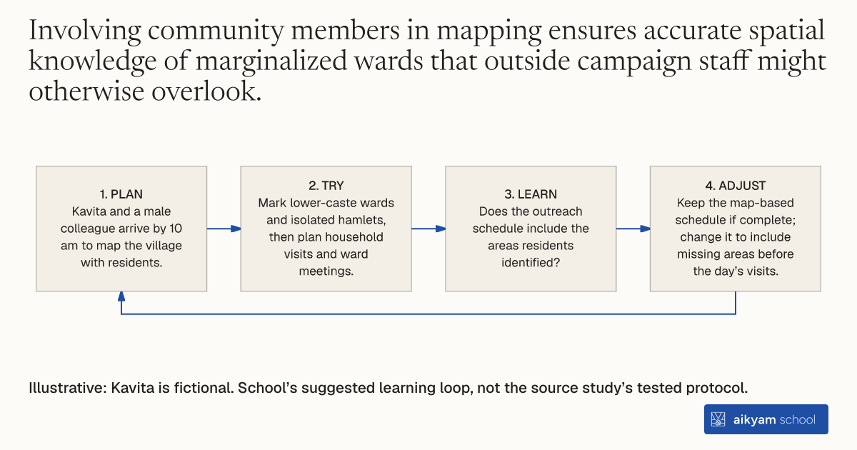
Try, learn and adjust
Check the outreach map includes isolated wards
- Plan: Kavita and a male colleague arrive by 10 am to map the village with residents.
- Try: Mark lower-caste wards and isolated hamlets, then plan household visits and ward meetings.
- Learn: Does the outreach schedule include the areas residents identified?
- Adjust: Keep the map-based schedule if complete; change it to include missing areas before the day’s visits.
Illustrative: Kavita is fictional. School’s suggested learning loop, not the source study’s tested protocol.
See source →School’s suggested learning loop, not a tested source procedure. Observe mapped areas and planned visits; mapping was part of a larger campaign.
How
When to use
In rural development and civic mobilization, campaigners often lack spatial and demographic information about isolated or lower-caste hamlets within a village. Participatory village mapping solves this by engaging local residents to identify distinct wards and lower-caste residential pockets early in a campaign day. This allows field teams to structure targeted door-to-door visits and ensure marginalized groups participate in civic activities.
Map a village collaboratively with local residents in the morning to identify lower-caste hamlets and organize campaign outreach.
- Deploy a two-person field team composed of one man and one woman to arrive at the village by 10 am.
- Gather local villagers in a central area to begin the morning session.
- Draw a spatial map of the village together with participating residents.
- Locate specific lower-caste residential areas, wards, and isolated hamlets on the map.
- Use the completed map to structure and schedule the day's door-to-door visits and ward meetings.
Why it works
Establishing this geographic structure early in the day enables field teams to reach vulnerable households systematically before larger public gatherings.
Example
A two-person NGO team from Sarathi implemented morning village mapping in rural villages across 36 clusters in Lalitpur, Bahraich, and Sitapur districts in Uttar Pradesh, India, during the 2007 state assembly election. The mapping structured an intensive one-day campaign that contributed to a 20% increase in reported NGO exposure and an 11% increase in male voter turnout.
About the study
Participants
The trial evaluated 36 village clusters (each containing 12 to 20 villages) across three central Uttar Pradesh districts, surveying 1,538 Hindu voters (including Scheduled Castes and Other Backward Castes).
Study Design
Researchers tested the mapping as part of a randomized cluster field experiment where two-person campaign teams mapped each treated village to target subsequent ward visits, evaluating exposure via a post-election private ballot household survey.
Results
Morning mapping successfully structured campaign activities, contributing to a 20 percentage point increase in reported NGO campaign exposure in treated villages (from 10% in control to 30% in treatment) and increasing overall voter turnout by 9 percentage points.